Get actionable intelligence to respond to your challenges with greater speed and greater certainty. Browse through the suite of satellite imagery from Airbus and select the one most suited to your needs. le


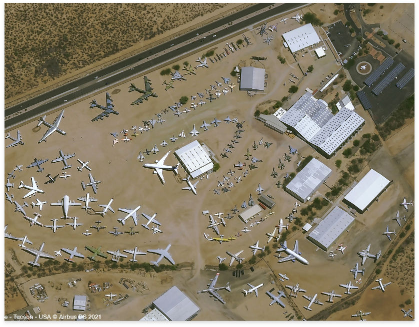
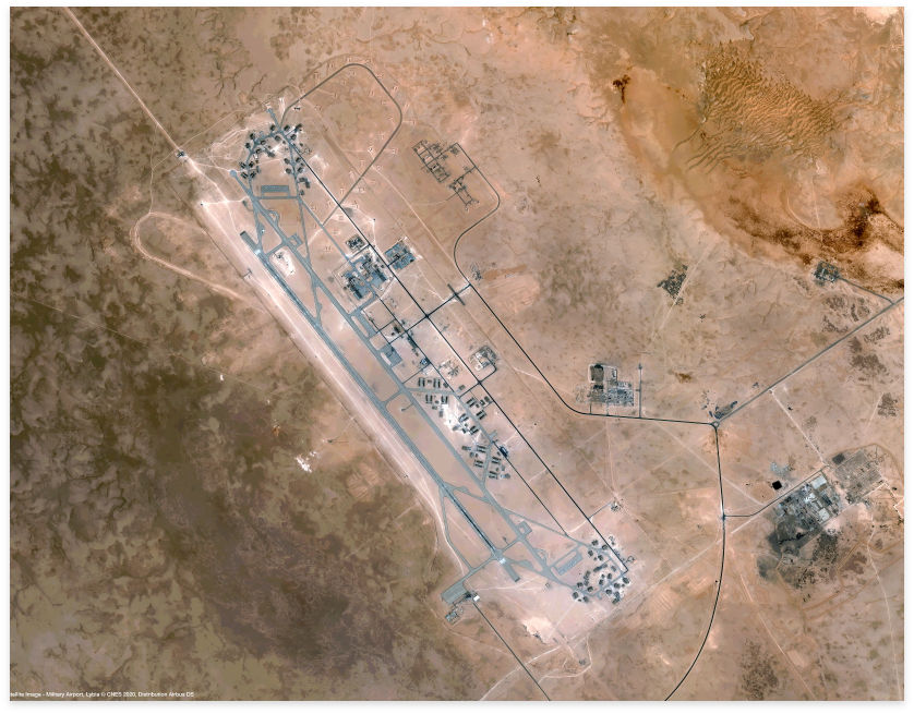
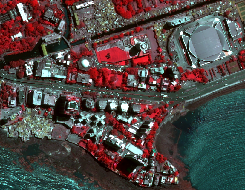
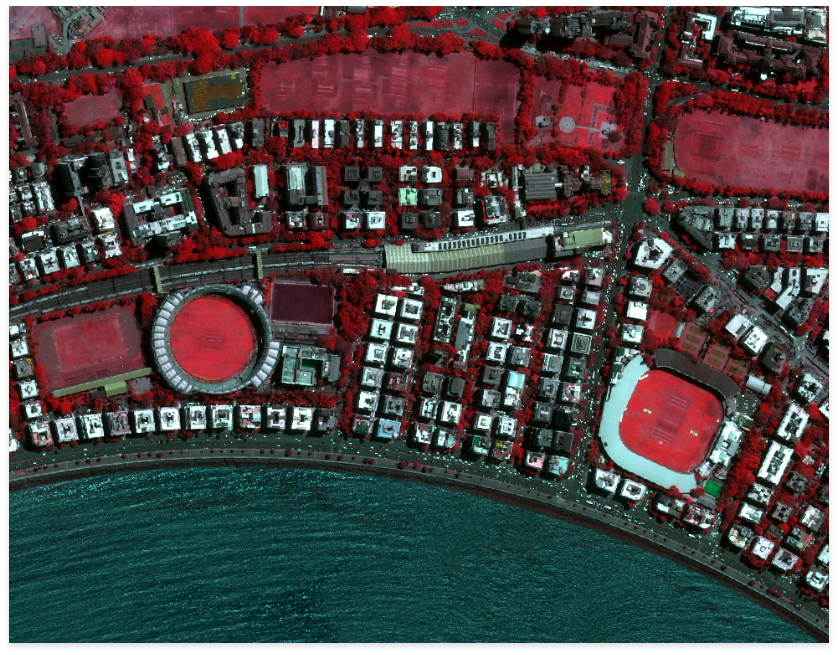
PLEAIDES NEO – 30 CM
VERY-HIGH RESOLUTION OPTICAL IMAGERY FOR AN UNPRECEDENTED LEVEL OF GEOSPATIAL SERVICES
Pleaides Neo is the most advanced optical constellation from Airbus. It features four identical 30cm resolution satellites and optimises each step of the satellite acquisition and delivery cycle.
KEY FEATURES
KEY APPLICATIONS:
Defence, Maritime, Urban, Mapping
VERY-HIGH RESOLUTION SATELLITE IMAGERY TO SPOT DETAILS
The identical satellites of Airbus, Pléiades 1A and Pléiades 1B deliver 50cm optical imagery in record time. Both the space and the ground segment have been designed to provide data in record time, offering daily revisit capacity anywhere on the globe.
KEY FEATURES
KEY APPLICATIONS:
Defence, Public safety, hazard management, urban mapping, precision agriculture, network and infrastructure administration.
SPOT 6/7 – 1.5 M
SOLUTION FOR COUNTRY-WIDE, DEMANDING APPLICATIONS
The SPOT constellation is specifically designed to efficiently cover huge areas in record time. With the current SPOT 6/7 satellites, Airbus continues the data delivery started with the launch of the original SPOT 1 satellite in 1986. Today the archive imagery gives access to unique historical high-resolution data collected over the last decade and spanning over billions of km². SPOT 6/7 secure data continuity will be until 2025 and 2027 respectively.
KEY FEATURES
KEY BENEFITS
Cartography, monitoring
RADAR CONSTELLATION
RADAR SATELLITE SERVICES OF UNIQUE PRECISION, QUALITY AND RELIABILITY
The Radar Constellation comprises TerraSAR-X, TanDEM-X and PAZ and provides reliable access to highly accurate Earth Observation data innear real-time, independent of weather and daylight conditions. The satellites carry a high frequency X-band Synthetic Aperture Radar (SAR) sensor in order to acquire datasets ranging from very high-resolution to wide area coverage.
KEY FEATURES
KEY APPLICATIONS
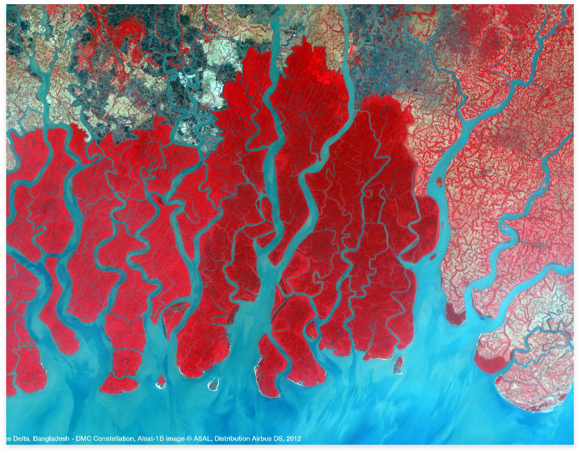
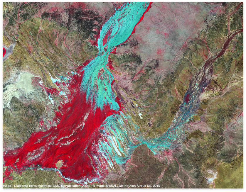
DMC CONSTELLATION
RAPID COVERAGE OF LARGE AREAS
The DMC Constellation acquires multispectral imagery at 22m resolution and provides rapid repeat coverage of the largest countries, regions and even continents.
The DMC Constellation acquires multispectral imagery at 22m-24m resolution and panchromatic imagery at 12m. Image size is adjustable up to very large images (i.e. 640 km x 1,300km). The constellation collects over 10,000,000km² per day and features a revisit frequency of 1 to 2 days anywhere on Earth.
KEY FEATURES
KEY APPLICATIONS
Change detection, forestry, agriculture, disaster management, land cover mapping and environmental monitoring
VISION-1
HIGH-RESOLUTION MONITORING SOLUTION
Vision-1 provides 0.9m resolution imagery with full end-to-end mission operation services in the panchromatic band and 3.5m in the multispectral bands (NIR, RGB), with a 20.8km swath width.
KEY FEATURES
KEY APPLICATIONS
Defence, Security, Maritime and Agriculture
DID YOU HAVE OTHER QUERIES ?
Micronet solution is there to support your business. We are ready to deliver.